Cityscan
Artistic, sensitive and digital cartography of the territory

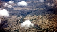
Cityscan is an urban study on a grand scale which aims to draw up a sensitive and digital cartography of the entire territory of the Cité Internationale Universitaire in Paris / Gentilly.
Throughout September, the contributors were in charge of collecting information of a sensitive, digital, urban, architectural, heritage, sociological and economic nature. They gathered this information in the field, on Internet or via information providers (industrialists, public authorities, associations and so on).
The data collected assumes very different forms: photographs taken from kites, sound recordings of the territory, statistical elements, in situ records from video surveillance cameras, air quality measurements, detailed plans of the territory, maps of mobility flow, of communication networks and traffic maps, interviews with local inhabitants, various articles and reports…
All of the data will then contribute to:
- a data base;
- a geographic information system (GIS): a collaborative, interactive map.
This cartography enables an artistic, sensitive and subjective representation of the data obtained during the project. This system was designed as a long-term tool, which anyone will be able to contribute to via Internet. It offers a general reappropriation of the territory.
The GIS is produced with the participation of the collective "Zoom+Infraksound+Damien Masson = pied la biche".